
Journal·July 10, 2026·geology · sedona-history · red-rocks · nature · local-knowledge
Four Hundred Million Years in the Making: How Sedona's Red Rocks Formed
The red rocks outside your window aren't just scenery — they're a 400-million-year archive of ancient seas, deserts, and rivers written in stone
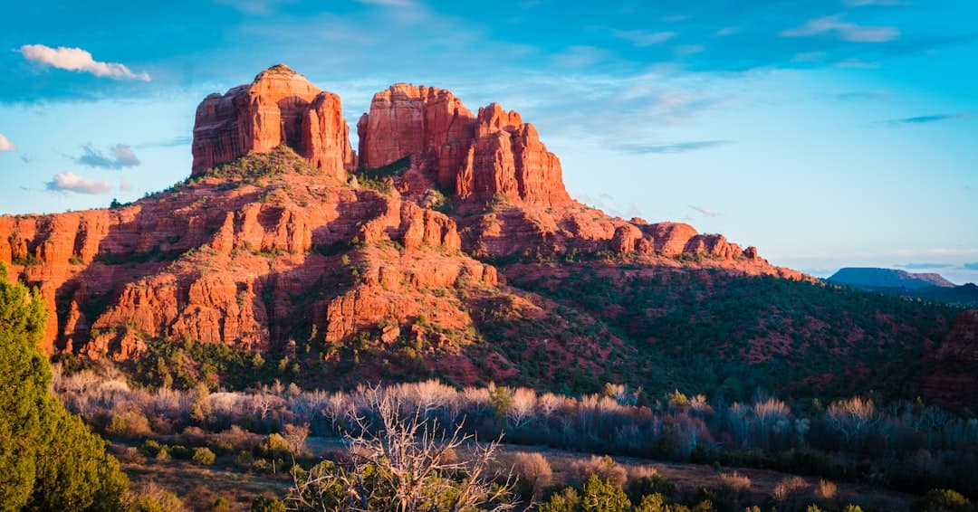
Photo by Kaileen Fitzpatrick on Unsplash
Standing at the trailhead of Airport Mesa at 6am, coffee in hand, I've thought more than once: how does this even exist? The rocks glow orange-red before the sun clears the ridge. They look almost painted. The truth of how they got here is stranger and more satisfying than any myth.
It Started With Sand. A Lot of Sand.
About 330 million years ago, this entire region sat near the equator, covered by a warm, shallow sea. When that sea retreated, it left behind limestone and mudstone — the pale, cream-colored rock you see at the base of formations like Courthouse Butte. That's the Redwall Limestone layer, and it predates the red stuff by tens of millions of years.
Then came the desert. A massive Sahara-scale dune field swept across the region roughly 270 million years ago. Those ancient sand dunes compressed over eons into the Coconino Sandstone — the pale band you'll notice near the tops of many formations. Look closely at Cathedral Rock or Bell Rock and you can actually see the diagonal lines where ancient dune faces were buried and preserved. It's called cross-bedding, and once you know what you're looking at, you can't unsee it.
Where the Red Comes From
The iconic rust-and-crimson color isn't the rock itself — it's iron oxide. Rust, essentially. The Schnebly Hill Formation, which makes up the bulk of what you're seeing in most of Sedona, was deposited around 270-280 million years ago when river systems carried iron-rich sediments across a broad floodplain. As those sediments dried and oxidized, the iron rusted in place. The deeper the red, generally the more iron-rich the original sediment.
The cooler, more muted pinkish hues you see in some layers? Less iron, or iron that oxidized under slightly different conditions. It's geology as color theory.
Bell Rock shows the layering clearly — paler Coconino Sandstone near the crown, the deep Schnebly Hill reds below. You can read the geologic timeline just by looking up.
Uplift, Erosion, and the Colorado Plateau
All that layered sediment sat flat for millions of years. Then, roughly 60-70 million years ago, the Colorado Plateau began to uplift — pushed skyward by tectonic forces nobody fully agrees on yet. The whole region rose thousands of feet. Water, wind, and freeze-thaw cycles got to work immediately.
Sedona sits at the edge of the Mogollon Rim, which is basically a dramatic escarpment where the Colorado Plateau drops toward the lower Sonoran Desert. Oak Creek carved its canyon through here. The softer rock eroded faster; the harder caprock — usually basalt from later volcanic activity — protected the rock beneath it. That's why you get mesas and buttes instead of just a flat plain. The hard stuff on top sheltered columns of soft stuff below.
Those volcanic intrusions matter, too. The dark rock you see capping formations like Wilson Mountain isn't the same sandstone as the rest. It's basalt from lava flows that poured across the plateau around 15 million years ago. In geological terms, that's practically yesterday.
What the Vortex Crowd Gets Right (Sort Of)
I'll be honest — I'm skeptical of a lot of the energy vortex talk you'll encounter in Uptown. But I do think people are responding to something real. The rock here is genuinely unusual. Some of it is paramagnetic, meaning it weakly responds to magnetic fields. The electromagnetic properties of the landscape are measurably different from average terrain. Whether that does anything to human consciousness is a different question, but the rocks themselves are not ordinary.
The Chapel of the Holy Cross was built directly into the Schnebly Hill Formation in 1956 — about 270 million years of geology serving as the foundation for 70 years of human architecture.
A Landscape That's Still Changing
Here's what I find genuinely humbling: this isn't finished. Every monsoon season strips a little more material from the formations. The frost cycles in winter expand cracks. Big rockfall events happen a few times a decade. The red rocks are eroding at a slow but measurable pace — faster at the base, which is why so many buttes are undercut at the bottom.
In another few million years, Bell Rock will be a much smaller thing. Probably a low hill. Then gone entirely.
If you get a chance while you're here, drive the Schnebly Hill Road — unpaved, high-clearance preferred — and pull off at any overlook. The exposed cliff faces there show the sedimentary layers more clearly than almost anywhere else. You can literally put your hand on 270 million years of desert dunes.
That's worth the washboard road.
Notes from Sedona
Want these in your inbox?
Once a month I send the new posts straight to subscribers. Skip checking the site.